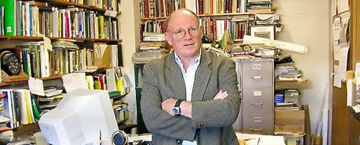
2019 Peter S. Thacher Award Recipient: Tom Eastler

Dr. Thomas Eastler was posthumously awarded the Peter S. Thacher Award at the 2019 NEARC Conference at Sunday River. This award was presented to his wife, Susan Eastler by one of Dr. Eastler’s former students, Mike Doyle.
Dr. Eastler was a career Air Force Officer as well as being a Geology Professor at the University of Maine at Farmington (UMF). Part of his military service included being one of the top Remote Sensing personnel in the Air Force, who was involved in troop deployment and battlefield planning for major operations. He used GIS and other tools in this pursuit. Dr. Eastler was also involved in many State of Maine initiatives, including- early on- the Maine Low Level Radioactive Waste. As part of this program he was able to get a Sun Sparc workstation and ArcInfo software for UMF which helped train generations of GIS Professionals in his classes.
Dr. Eastler, with his students, used GIS for many local projects including helping local farmers deal with river meanderings and crop management. Other students designed other projects which, where possible, he forged meetings between his students and stakeholders which included projects at ski areas different parks, lakes, etc.
Dr. Eastler was tireless in helping and mentoring his students- throughout their life. By no means did his teaching and friendship end at graduation. Dr. Eastler was yet another example of “Think Global, Act Local” using GIS as a tool to that end.