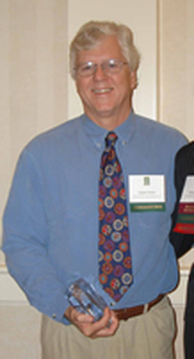
2006 Peter S. Thacher Award Recipient: Sandy Prisloe
|
This year's recipient of the Thacher Award is Sandy Prisloe from Connecticut.
At this year's Northeast Arc Info Users Group conference held in Groton, Sandy Prisloe, a Geospatial Extension Specialist for the University of Connecticut (UConn), was presented the Peter S. Thacher Award. Shaw Thacher, Peter's son, was on hand to congratulate Sandy. Sandy has been working in the GIS field since the late 80's, beginning with managing the early development of Connecticut DEP's first GIS. While at the DEP, he worked on the Broad Brook Ellington Project in collaboration with USGS. The project created numerous digital GIS datasets for two USGS quadrangles and demonstrated how the data could be used to support a variety of planning applications. (This was way back when people had no idea what GIS stood for let alone what it could do.) The project was showcased - in what became nicknamed the "Star Wars" room - at the Annual Meeting of the Association of American State Geologists held in Mystic, CT. During development of the project, Sandy got to spend time at the USGS National Office in Reston, VA and the EROS Data Center in Sioux Falls, SD (always in the dead of winter). While at the DEP, Sandy was invited to develop and teach an introductory GIS class in the UConn Geography Department, where he served as an adjunct faculty member for 3-4 years. He helped establish the GIS program at the Long Island Sound Research Center (LISRC) at Avery Point. After leaving the DEP in 1992, Sandy founded Envirographics, a GIS consulting firm and reseller of ESRI software. He ran the business for six years, ultimately selling it to join the faculty of the Cooperative Extension System at UConn. During this time, he was also an adjunct faculty member at the University of New Haven in the Environmental Sciences Program. He developed and taught a four-course sequence of GIS courses, which were part of a Masters Program concentration or could be taken to earn a GIS certificate. At UConn, Sandy heads the Geospatial Technology Program in the Center for Land Use Education and Research. He has overseen the development and teaching of a number of hands-on geospatial training courses including "Geospatial Technologies at Work," an introduction to GIS designed for land use decision makers, and "Pictures, Points and Places," an introduction to GPS that focuses on how to integrate digital pictures with GPS, GIS and Google Earth. In addition to teaching, Sandy also has been involved in research projects that focus on the use of GIS and remote sensing. Most recently he has been investigating methods to detect and map Phragmites australis, an invasive reed, in the state's tidal wetlands. Not only is Sandy involved in research and teaching, but he has written and coauthored a number of papers, two of which received the ESRI first place award for best paper in GIS given at the Annual Conference of the American Association of Photogrammetry and Remote Sensing. With Jon Scull, Sandy conceived and organized the Connecticut GIS User to User Network, a voluntary association of GIS professionals in Connecticut, and is currently serving as the Network's President. He is the UConn representative to the Connecticut Geospatial Council and co-chair of its Education and Training Working Group. Sandy truly enjoys teaching, and loves to see the enjoyment that people experience when they start to "get it" with GIS. He likes to learn from his students about how they plan to use GIS and/or GPS in their jobs or volunteer work. He loves the opportunity to be involved in research into how GIS, GPS and remote sensing can be used to create new data, such as Connecticut's land cover data, impervious surface mapping or mapping invasive species in tidal wetlands. Working at UConn provides Sandy with the best of all possible worlds…working with, teaching and researching geospatial technology. Sandy lives in Chester with his wife of 30 years! They have a daughter and a real crazy nutcase border collie. In his "free" time, Sandy is Chairman of the Chester Conservation Commission and is a member of the Camp Hazen Board of Directors. He has recently become interested in geocaching, and enjoys kayaking the Connecticut River and its creeks and tributaries. Congratulations Sandy! |
